
")
CA MAU OVERVIEW


City/District
Coordinates
- Ca Mau positioned at 8°34′ to 9°33′ North latitude and 104°43′ to 105°25′ East longitude
- Over 300 km distance from Ho Chi Minh City (Road)
- About 150 km southward to Can Tho (Road)

Bordering
- The North borders Kien Giang Province
- The Northeast borders Bac Lieu Province
- The East and Southeast borders the East Sea
- The West and Southwest borders Gulf of Thailand
- Ca Mau is assumes a special role in politics, security and economics of the Mekong Delta. the province is one of four economic hubs of the Mekong Delta. It is also part of the Eastern Coastal Economic Corridor of the Southwestern Coastal Zone consisting of Bac Lieu, Ganh Hao, Ca Mau, Nam Can, and the Southern Development Corridor including Bangkok, Phnom Penh, Ha Tien.
- Also, Ca Mau is the country gateway to oil and gas exploration and exploitation in the ocean water surrounded by other Southeast Asian countries, especially in the Gulf of Thailand – where there is large oil and gas reserve.
natural conditions
- Acereage: 5.329 km² / 5,329 km²
- Occupy a proportion:
- 13.13% Acreage of Mekong Delta region
- 1.58% Acreage of whole country
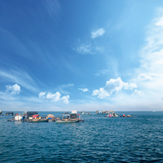
- Coastal length: over 254 km
- Fishing area: over 70,000 km2

NATURAL RESOURCES
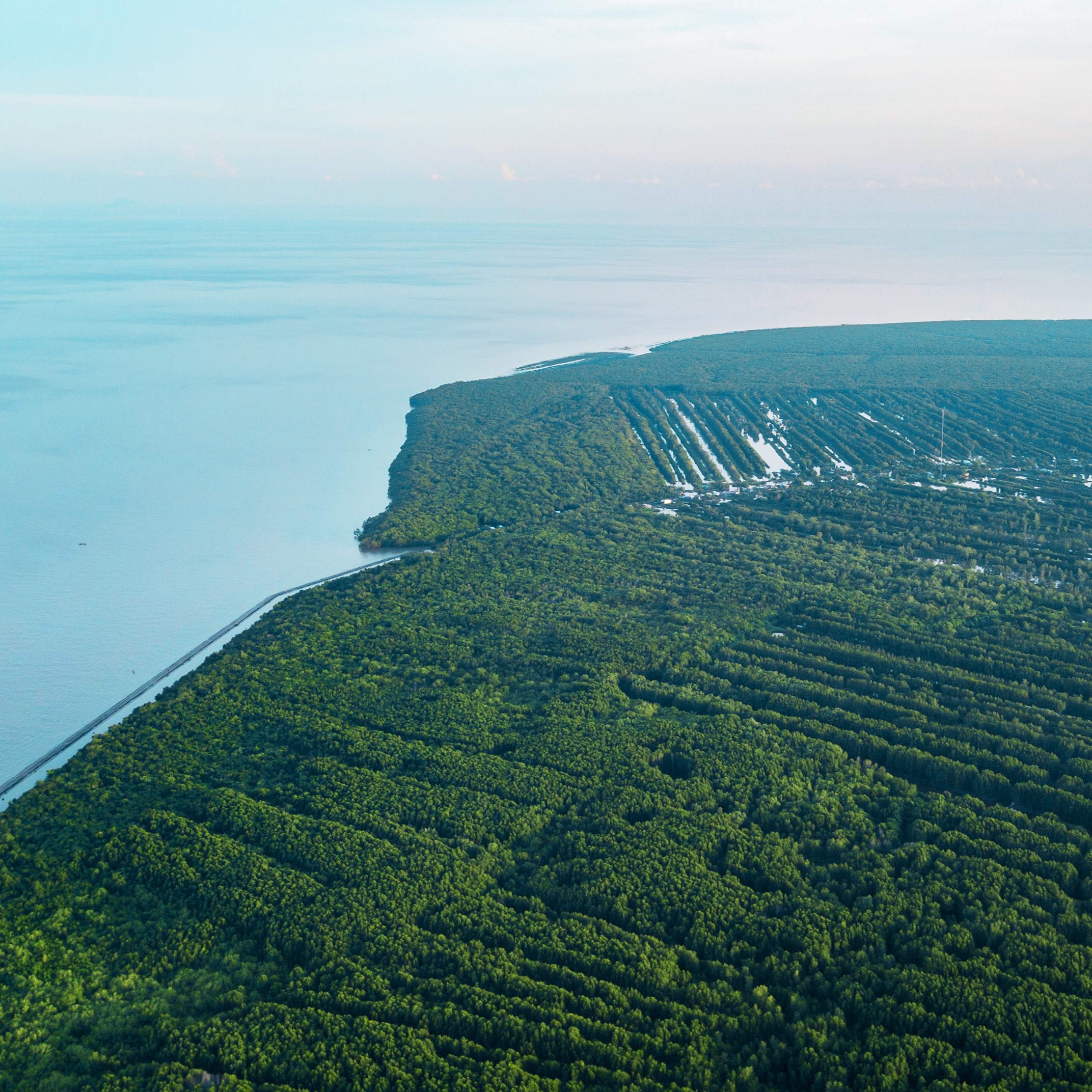
Ca Mau possesses rich natural resources and high economic value:

Natural resources have given Ca Mau great potential for comprehensive economic development,
especially fisheries, ecotourism and maritime tourism.
social conditions
Population
With a relatively high labor force age structure, Cà Mau provides an abundant workforce for businesses investing in the area.

Education and Training System
In order to provide high quality human resources for organization and investors to invest in the province, in recent years, Ca Mau province has been actively investing in education to improve the quality of human resources. In particular, the province has been investing in several projects to promote higher and post graduate education for local students.

energy
The development of renewable energy in general and wind energy in particular is part of the Province’s future development. At present, the Provincial Plan for the period 2021 – 2030, with a vision to 2050, has been drafted and submit to the central goverment for consideration and approval. The plan sets out goals for developing the province’s energy infrastructure and investment portfolio of renewable energy projects, including near-shore and offshore wind power projects.
infrastructure
Located in the center of the Ca Mau peninsula, Ca Mau Airport holds an important position in the economic, cultural, social, security and defense development of Ca Mau province and Mekon Delta region. it is part of province infrastructure development toward Ca Mau city being recognised as class 2 city in near future.

- National level road in Ca Mau territory:
- Number of routes: 5
- Total length: 220.09 km
- Interprovincial and district roads:
- Number of main routes: 16
- Total length: 343.56 km

Industrial Parks
Industrial Park
Khanh An Industrial Park
1. Location: Khanh An commune, U Minh district, Ca Mau province (adjacent to Ca Mau Gas – Electricity – Fertilizer Industrial Cluster). 10 km from Ca Mau City center and 12 km from Ca Mau airport, 40 km from Song Doc estuary (Tran Van Thoi district, Ca Mau province), 63 km from Nam Can port (Nam Can district, Ca Mau province). km, 295 km from Can Tho port, 2,000 ton ships can travel easily.
2. Geographical location:
– Bordered to the East: Ong Doc River.
– The West borders: Vo Van Kiet Street and existing aquaculture land.
– Bordered to the South: Khanh An Industrial Park expansion phase 2 planning (current status of aquaculture land).
– The North borders: Ca Mau Gas – Electricity – Fertilizer Industrial Cluster.
3. Total area: 235.86 hectares, cleared land.
Of which,
– industrial land is 147.86 hectares.
– Leased: 125.32 hectares (of which the factory construction area is 114.92 hectares/164.11 hectares);
– Unleased industrial land area: 49.19 hectares (of which investment policies have been granted to 07 businesses with a total area of 30.99 hectares, currently businesses are completing land lease procedures, the remaining area again 15.94 hectares, continuing to invite investment).
Expanded Khanh An Industrial Park: Procedures are being carried out to expand Khanh An Industrial Park by 345 hectares.
Information – Communication
Infrastructure
urrently, 100% of communes, wards and towns have fiber optic Internet and cable systems 3G and 4G mobile network coverage.
The province’s IoT platform is initially deployed based on the 4G platform allows sensors placed in different locations to measure water levels and degrees salinity, pH, dissolved oxygen, solids… transmitted in real time to the province’s DC for storage storage and handling. Through APIs, the system can connect to other systems at Other units such as the Department of Natural Resources and Environment and the Department of Agriculture and Development rural areas to share and provide data.

Developing digital platforms
The province’s LGSP platform has been connected to national information systems and databases through the NDXP axis such as: National database on business registration, national database Expert in legal documents, insurance database, online judicial record card issuance system line, Information system for civil status registration and management, Unit code issuance system has a relationship with 7 budget, information system manages the shared electronic catalog of state agencies to serve distribution e-Government development, System of Vietnam Post Corporation. Recently, The province has been experimentally connected to the national population database of the Ministry of Public Security
